
Flooding is one of the most catastrophic and frequently occurring natural disasters, causing infrastructure damage, property damage, and loss of life. North Carolina Agricultural and Technical State University (NC A&T) is leading efforts to better understand and quantify flood water extent and depth through the use of drone imagery, satellite imagery, and machine learning methods to develop a georeferenced 3D flood extent model. The project team includes members from NC A&T, North Carolina Department of Public Safety, NOAA Southeast River Forecast Center, NOAA National Weather Service, Axiom Data Science, and SECOORA.


Project Area
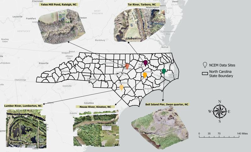
North Carolina has experienced many devastating tropical storm and hurricane events which have caused extensive flooding statewide. The project team is using satellite imagery and flying drones to collect data in flood-prone areas of eastern North Carolina and in the Asheville, NC region. Satellite and drone operations capture the study areas during normal and flood conditions. The National Weather Service Offices in Newport/Morehead City and Wilmington have extensive flood records for eastern North Carolina from hurricanes Matthew and Florence. Both offices helped define the study areas.
Collecting Drone Data
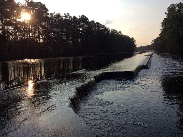
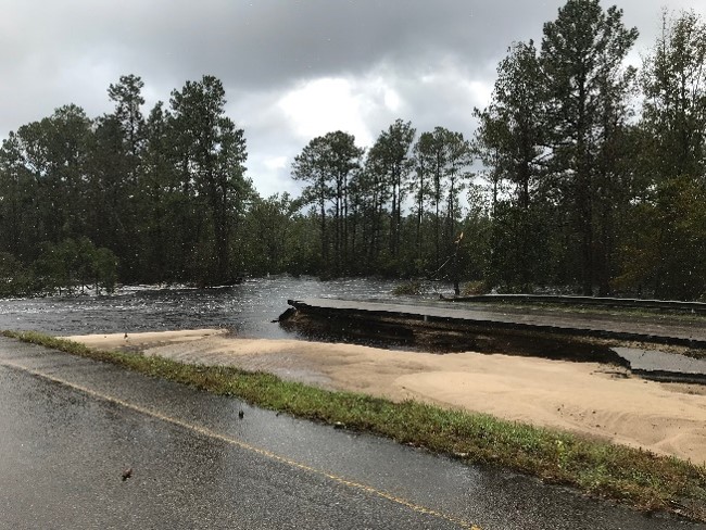
Flood modeling and management is challenging when only using space-borne satellite data. Dense cloud cover, complex urban landscapes, and heavy vegetation or tree canopy cover can limit the usefulness of satellite data. Unmanned Aerial Vehicles – aka Drones – have been recognized as a new tool for the collection of high quality geospatial data. Drones can provide fast and accurate detection of flooded areas. NC Department of Public Safety has conducted over two years of drone surveys within the study area. Drones provide fast and accurate detection of inundated areas and can easily access hazardous environments that are otherwise inaccessible. Drone and satellite data are being combined to train and validate the flood extent model under development by NC A&T. Data collected during this project will be publicly-accessible through the project documentation page.
Improving Natural Disaster Management Practices
NC Department of Public Safety will use the project results to improve the natural disaster management practices. They will be able to identify locations where emergency services are most critical just after a flood event. The results will also provide NOAA Southeast River Forecast Center and National Weather Service with tools to evaluate existing flood inundation maps.
This two-year project is funded by the NOAA Weather Program Office Research Programs (NOAA-OAR-WPO-2021-2006592).